What Causes the Direction of the Wind to Change from Day to Night?
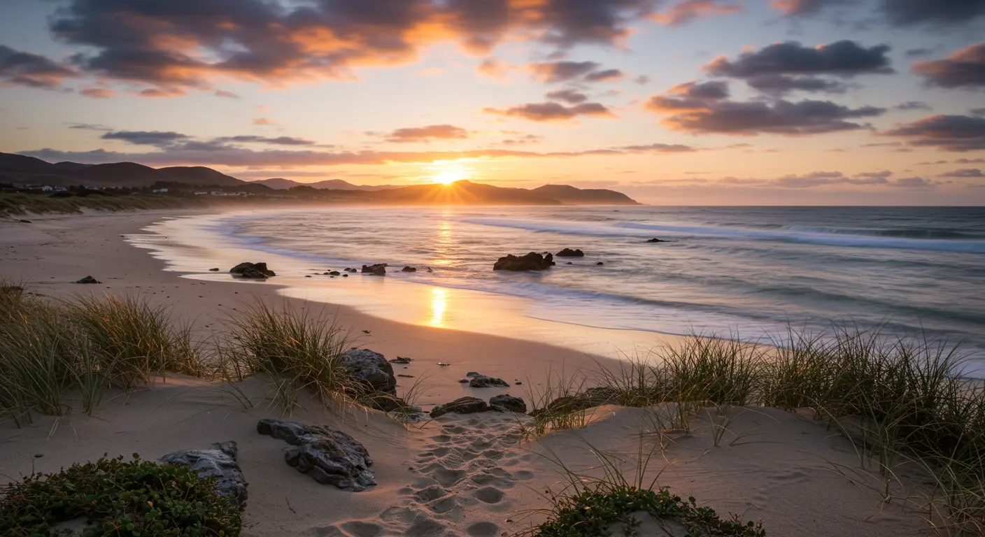
Land Breeze – The Nighttime Wind
When darkness blankets the coast, nature creates a fascinating thermal reversal. The land, having basked in sunlight all day, now surrenders its heat rapidly through radiational cooling. Meanwhile, the ocean—that vast thermal reservoir—holds onto its warmth much longer.
This temperature contrast creates a new pressure landscape. Cool, dense air settles over the land like a heavy blanket, forming a high-pressure dome. Above the warmer waters, air rises in invisible columns, carving out a low-pressure valley. The result? Wind flows seaward, reversing the day’s pattern entirely.
These nocturnal winds whisper more softly than their daytime cousins, with speeds typically ranging from 3 to 7 mph. They emerge gradually after sunset, reach their peak during the pre-dawn hours when thermal contrasts peak, then fade as morning light rekindles the land’s warmth.
These offshore winds have several practical implications:
-
Navigation: They can help push fishing boats away from the shore in the early morning.
-
Fishing: They may transport terrestrial scents seaward, attracting certain fish species.
-
Air Quality: They can temporarily move air pollution from coastal communities out to sea.
-
Weather: They can contribute to the formation of offshore fog or nighttime thunderstorms over warm coastal waters.
This rhythmic dance between day and night winds has captivated coastal dwellers for millennia, from ancient mariners timing their departures to modern beach goers planning their activities.
Sea Breeze – The Daytime Wind
When the sun climbs high, coastal regions come alive with sea breezes—nature’s own air conditioning system. This phenomenon springs from a simple yet profound difference: land absorbs solar energy rapidly, heating up roughly five times faster than the adjacent sea with its impressive thermal capacity.
As land temperatures soar, the air above begins its upward journey, creating a vacuum-like low-pressure zone. Air naturally moves to balance these pressure differences. The cooler, denser air hovering over the sea rushes inland to fill this void, creating the refreshing onshore breeze that coastal communities cherish.
These maritime messengers typically stir to life mid-morning, gather strength through the afternoon heat, and can march several miles inland depending on topography and atmospheric conditions. These winds typically range from 5 to 15 mph and provide natural cooling to coastal communities.
The sea breeze forms a continuous atmospheric circulation—air ascends over heated land, glides seaward at altitude, descends over cooler waters, then returns landward at surface level. This circulation often spawns a distinct “sea breeze front” where maritime coolness collides with continental warmth.
Sea breezes offer several practical benefits beyond temperature moderation:
-
Air Quality: They improve air quality by dispersing urban and industrial pollutants.
-
Recreation: They create ideal conditions for sailing and windsurfing.
-
Fishing: They can influence the behavior of marine species by altering water movements.
As twilight descends upon coastal regions, the wind patterns begin to shift. The wind patterns that ruled the daylight hours begin their nightly metamorphosis, ushering in the land breeze—the sea breeze’s quieter, nocturnal twin.
This wind reversal depends on a key principle: land and water cool at dramatically different rates. While land heats rapidly during the day, it also releases this heat quickly after sunset. Water, with its higher thermal inertia, retains much of the warmth it absorbed throughout the day. Now the situation reverses—water becomes the warmer surface.
This temperature change creates a pressure shift. Cool air over land grows heavy and sinks, creating a high-pressure area. Meanwhile, the relatively balmy air above water rises like invisible smoke, forming a low-pressure zone offshore. Air flows in response to these pressure differences, now flows from land to sea—a complete reversal of the day’s choreography.
These offshore winds typically awaken a few hours past sunset, when temperature differences become most pronounced. They reach maximum strength in the pre-dawn hours, when temperature differences are greatest. These offshore winds are usually gentler than their daytime counterparts, typically ranging from 3 to 8 mph, as nighttime temperature differences tend to be less pronounced than those during peak daylight hours.
For coastal communities, land breezes offer practical gifts. Fishermen use these offshore winds to their advantage, riding them to distant fishing grounds in the early morning hours. The breeze carries land-based scents seaward—a natural attractant that may lure certain fish species closer to shore.
What drives this daily wind cycle? The answer lies in how temperature differences create pressure changes—a relationship that forms the very backbone of our planet’s breathing patterns.
When sunlight floods the Earth, it affects surfaces differently. Land surfaces absorb solar energy quickly, while water bodies heat up more gradually, their thermal properties demanding patience. This creates a temperature chasm between adjacent land and water.
A basic atmospheric principle applies: air flows from high to low pressure following natural pressure gradients. This invisible force drives the daytime spectacle—maritime air streaming landward in what we celebrate as the sea breeze.
At night, the temperature pattern reverses completely. Land surfaces rapidly radiate their accumulated heat back into the atmosphere, cooling much faster than water bodies, which retain their thermal energy longer. The temperature difference reverses—now it’s cool land beside warm water. The cooler air over land becomes denser and sinks, establishing a high-pressure area. Meanwhile, the relatively warmer air over water rises, creating a low-pressure zone. The pressure pattern changes accordingly, directing winds from land to water in night’s gentle land breeze.
This cyclical drama isn’t confined to coastlines. Mountain regions experience similar thermal patterns, where valley floors and slopes experience different heating rates. Sunny slopes warm faster than shadowed valleys, creating up slope winds by day. Come nightfall, the pattern reverses—cool mountain air flows down slope.
These wind patterns vary with temperature differences—the greater the thermal gap, the stronger the breeze. Seasonal factors, cloud cover, and regional climate conditions can all influence the strength of the resulting pressure gradients and, consequently, the force of the winds they generate. Where temperature differences are small, or where large weather systems dominate, these delicate local winds may fade into the background.
Why do land and water dance to such different thermal rhythms? The secret lies in a fundamental property called specific heat capacity—nature’s way of determining how materials respond to heat.
Water has an exceptionally high specific heat capacity compared to land. Think of it this way: water requires much more energy to heat up than land does.
This property creates the temperature gaps that fuel our daily wind cycles. During daylight hours, land surfaces rapidly absorb solar radiation and heat up, while nearby water bodies remain relatively cooler. Temperature gaps of several degrees emerge, creating the pressure differences that drive sea breezes inland. As night falls, the situation reverses—land quickly radiates its heat and cools, while water retains much of its accumulated thermal energy, becoming the warmer surface.
The numbers tell a striking story: water demands roughly five times more energy than dry soil to achieve the same temperature rise. This isn’t just a scientific curiosity—it’s why oceans and large lakes serve as Earth’s thermal shock absorbers, smoothing out temperature extremes and creating the steady thermal contrasts that birth predictable wind patterns.
This creates a continuous cycle. By day, heated land sends air skyward, creating a vacuum that draws cooler maritime air inland. By night, the roles reverse—warmer water launches air upward, pulling the now-cooler continental air seaward.
Influence of Atmospheric Conditions on Wind
Local thermal patterns don’t exist in isolation—they interact with larger atmospheric systems that can strengthen, weaken, or override them completely.
Key atmospheric factors include:
-
Pressure Systems: Large-scale high or low-pressure systems can amplify or suppress local winds. A strong prevailing wind from a weather system can completely mask the sea breeze effect.
-
Cloud Cover: Clouds reduce solar radiation during the day, weakening sea breezes. At night, they trap heat, weakening land breezes. The strongest diurnal winds occur on clear, sunny days.
-
Humidity: Since moist air is less dense than dry air, humidity levels can alter the density contrast between air masses, affecting wind strength.
-
Seasonal Variations: Diurnal winds are typically strongest in summer when the sun’s radiation creates the largest temperature differences between land and sea.
Coriolis Effect and Wind Direction
The Coriolis effect—caused by Earth’s rotation—influences all moving air masses. This invisible force deflects winds rightward in the Northern Hemisphere and leftward in the Southern, acting as a constant deflecting force across the planet.
Wind movement becomes a three-way dance between pressure gradients (pushing air from high to low), Coriolis forces (deflecting that flow), and surface friction (adding drag to the mix). The result? Winds spiral clockwise around Northern Hemisphere highs and counterclockwise around lows, with Southern Hemisphere patterns mirroring this behavior.
This rotational influence grows stronger with distance from the equator and wind velocity. Near the equatorial belt, Coriolis forces are weaker, allowing breezes to flow more directly between pressure zones. However, in mid-latitude coastal regions, the Coriolis effect causes these breezes to deflect noticeably from their expected path. A North American sea breeze might arrive from the southeast rather than due east, due to this deflecting force.
This force balance means wind rarely takes the direct route from high to low pressure. Instead, it crosses isobars at an angle—a fundamental principle that makes accurate weather prediction possible.
Diurnal Wind Patterns and Their Importance
Diurnal winds are among nature’s most predictable patterns—local, thermally-driven cycles that reverse direction with clockwork precision. They reach their finest expression along coastlines and in mountainous terrain, where temperature differences are most pronounced.
These predictable patterns are important for several reasons:
-
Navigation and Aviation: Sailors have long used these winds for travel, and pilots account for them during takeoff and landing.
-
Climate Regulation: They moderate local temperatures and distribute moisture by facilitating air mass exchange.
-
Air Quality: This natural ventilation helps disperse pollutants in urban and industrial areas.
-
Renewable Energy: Their predictability is valuable for forecasting wind power generation.
Understanding how these thermal patterns interact with persistent forces like Coriolis deflection is essential for reliable weather prediction. Changes in these patterns can serve as early warning signals of broader climatic transformations.
